


ST JOSEPH 1 Voting District, Champaign County, Illinois
About
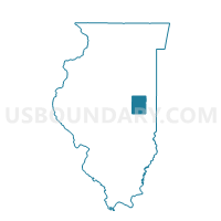
Outline

Summary
| Unique Area Identifier | 564720 |
| Name | ST JOSEPH 1 Voting District |
| County | Champaign County |
| State | Illinois |
| Area (square miles) | 30.51 |
| Land Area (square miles) | 30.40 |
| Water Area (square miles) | 0.11 |
| % of Land Area | 99.65 |
| % of Water Area | 0.35 |
| Latitude of the Internal Point | 40.09184850 |
| Longtitude of the Internal Point | -88.08056980 |
Maps


Graphs
Select a template below for downloading or customizing gragh for ST JOSEPH 1 Voting District, Champaign County, Illinois


Neighbors
Neighoring Voting District (by Name) Neighboring Voting District on the Map
- OGDEN 1 Voting District, Champaign County, IL
- PHILO Voting District, Champaign County, IL
- SIDNEY Voting District, Champaign County, IL
- SOMER Voting District, Champaign County, IL
- SOUTH HOMER Voting District, Champaign County, IL
- ST JOSEPH 2 Voting District, Champaign County, IL
- STANTON Voting District, Champaign County, IL
- URBANA 1 Voting District, Champaign County, IL
- URBANA 4 Voting District, Champaign County, IL
Top 10 Neighboring County Subdivision (by Population) Neighboring County Subdivision on the Map
- Urbana township, Champaign County, IL (7,451)
- St. Joseph township, Champaign County, IL (5,876)
- Philo township, Champaign County, IL (1,954)
- Sidney township, Champaign County, IL (1,733)
- Ogden township, Champaign County, IL (1,680)
- South Homer township, Champaign County, IL (1,601)
- Somer township, Champaign County, IL (1,268)
- Stanton township, Champaign County, IL (505)
Top 10 Neighboring Place (by Population) Neighboring Place on the Map
Top 10 Neighboring Elementary School District (by Population) Neighboring Elementary School District on the Map
- St. Joseph Community Consolidated School District 169, IL (6,191)
- Prairieview-Ogden Community Consolidated School District 197, IL (2,432)
Top 10 Neighboring Secondary School District (by Population) Neighboring Secondary School District on the Map
Top 10 Neighboring Unified School District (by Population) Neighboring Unified School District on the Map
- Urbana School District 116, IL (51,198)
- Tolono Community Unit School District 7, IL (9,017)
- Heritage Community Unit School District 8, IL (3,107)
Top 10 Neighboring State Legislative District Lower Chamber (by Population) Neighboring State Legislative District Lower Chamber on the Map
Top 10 Neighboring State Legislative District Upper Chamber (by Population) Neighboring State Legislative District Upper Chamber on the Map
Top 10 Neighboring 111th Congressional District (by Population) Neighboring 111th Congressional District on the Map
Top 10 Neighboring Census Tract (by Population) Neighboring Census Tract on the Map
- Census Tract 109, Champaign County, IL (9,302)
- Census Tract 107, Champaign County, IL (8,057)
- Census Tract 56, Champaign County, IL (6,853)
- Census Tract 55, Champaign County, IL (5,635)
- Census Tract 108, Champaign County, IL (4,534)
- Census Tract 57.02, Champaign County, IL (3,015)
- Census Tract 54.02, Champaign County, IL (2,927)